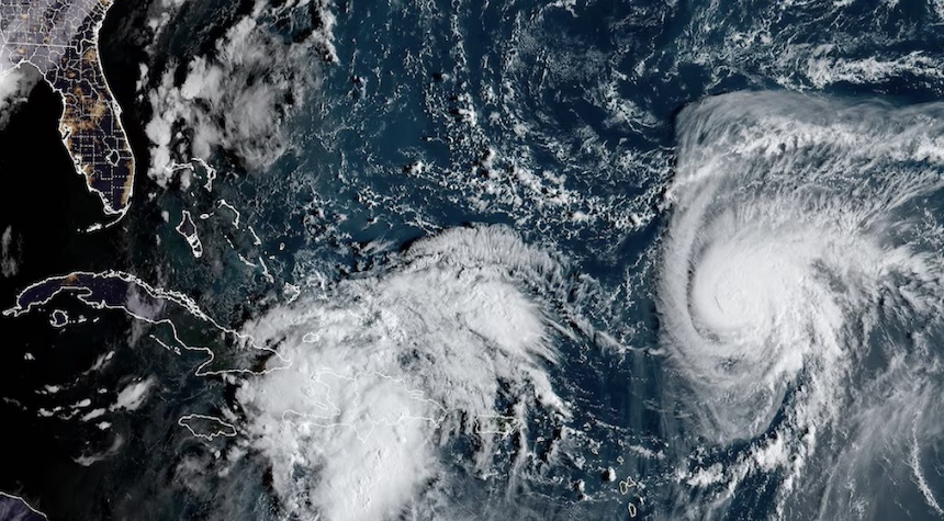
The Carolinas might be hit by a fresh tropical system, potentially a hurricane, next week, which could result in substantial flooding.
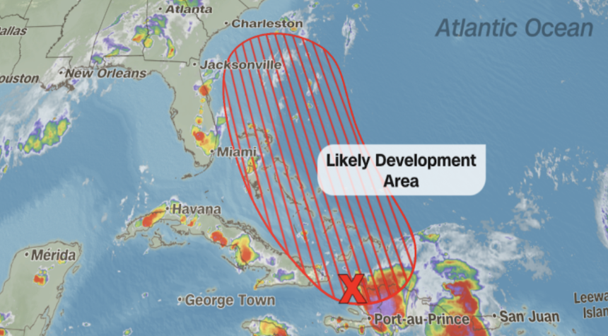
The system, due to be christened Imelda, may escalate to a tropical storm on Saturday and could morph into a hurricane by Sunday or Monday. It’s projected to cross the Bahamas this weekend before heading north. Though the exact route is not yet fixed, it is anticipated to affect the Southeast coast.
By Monday afternoon and Tuesday, the storm’s epicenter is predicted to be close to the South Carolina coast. The most intense rain and winds are expected from South Carolina to Virginia, with storm surge and coastal flooding also probable.
Also Consider Reading: Pope Selects New Archbishop for New Orleans After Abuse Case Settlement
This system will also interact with a stationary front along the coast, which could cause the storm to stall and result in several days of rainfall. Flooding remains the greatest risk, while damaging winds and storm surge are also plausible, contingent on the storm’s strength as it nears the coast.
“According to reliable sources…” If Imelda materializes, it could develop into a Category 1 or 2 hurricane, but at this stage, a major hurricane, that is Category 3 or higher, is not anticipated.
Charleston officials are preparing for a possible impact, stating on Thursday that stormwater pumps have been deployed, high-water vehicles are being prepared, and a sandbag plan is in process. “We have also ordered that all the lakes be lowered,” Mayor William Cogswell noted during an emergency city council meeting.
Charleston Chief Fire Marshal Michael Julazadeh emphasized, “Even though this has not formed yet, we are treating it as if we’re expecting some kind of impact. We don’t want to downplay the scenario — we want everybody to begin to prepare.”
Simultaneously, Hurricane Humberto, currently classified as a Category 1 storm, is brewing in the Atlantic and could intensify into a major hurricane over the weekend, staying hundreds of miles away from the U.S., and eventually veering northwest and proceeding out to sea without making landfall.
As we closely monitor these developments, we’re reminded of the need for preparedness, caution, and a timely response to information from meteorological experts.